MapInfo Pro
MapInfo Pro
20Years’ Experience in GIS
We have Lot’s of Success Stories
A complete, desktop mapping solution for the geographic information system (GIS) analyst to manage, analyze, visualize, and publish location-based data.
Explore
MapInfo Pro is an interactive tool that lets a user bring in data and visualize it on a map with symbols, themes and labels and overlay multiple datasets to see patterns that would not be visible otherwise. For example, the success of a wireless network depends upon the optimal placement of devices in the field and the infrastructure to support it including service technicians and account managers.
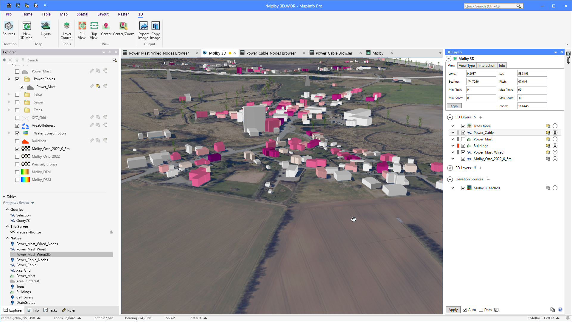
Viewing your data in 3D brings a new perspective
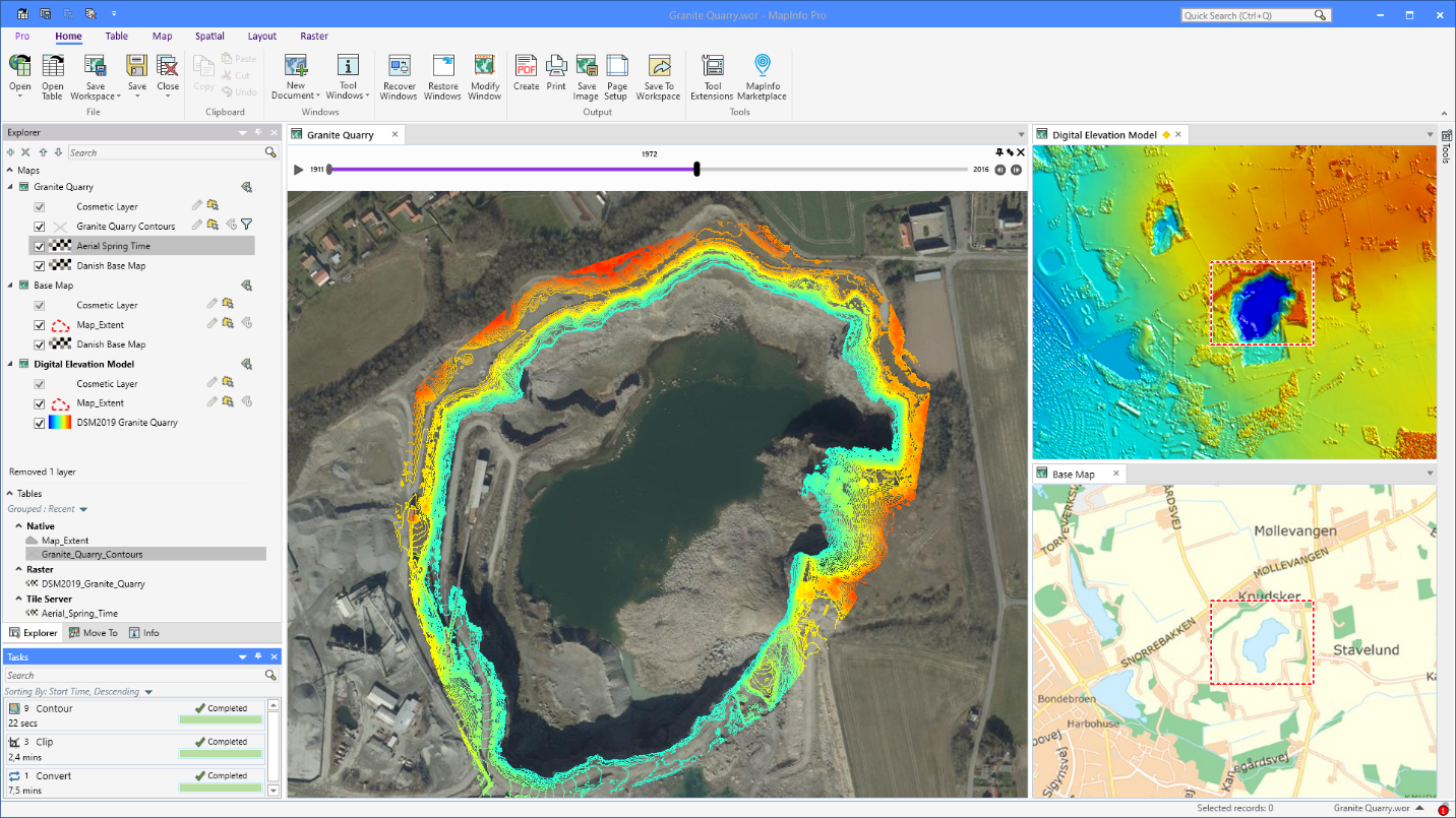
Time series analysis of granite quarry extraction
Model
MapInfo Pro helps you manage and visualize data in one place. Through our solution, customer data is integrated with maps, demographics and then combined with powerful querying and modeling tools. This enables your models to be built and tested much more quickly and inexpensively than real world decisions. Over time, they can dramatically improve the return on investment in location decisions.
By taking analysts’ insights, proper modeling is delivered to the decision-makers in a way that is actionable and impactful. MapInfo Pro enables you to build and distribute the tools to support good decisions. A picture may be worth a thousand words, but you still need to know which pictures and which thousand words to present to the decision-maker to help them succeed.